-

WP1 – Coordination and Management
Objectives: Effective Coordination and Management of the project. Description of Work: WP1 will deal with the overall financial, administrative, and operational management of the project
Read more -
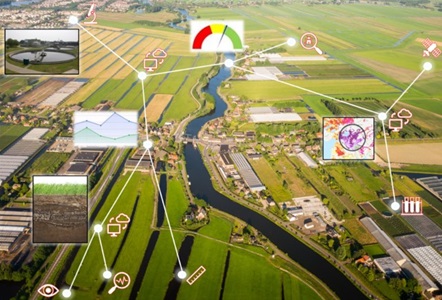
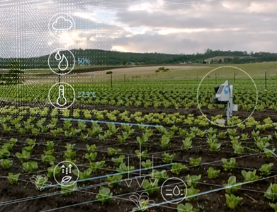
WP2 – Development of Digital Twin
Objectives: Evaluation, improvement, adaptation, and integration of algorithms for the various components and development of the Digital Twin, which is the core of DT-Agro. Description
Read more -
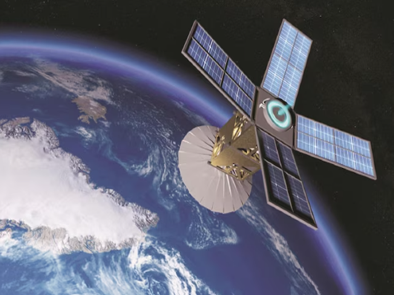
WP3 – Earth Observation
Description of Work: EO data sources and techniques relevant to the scope of DT-Agro will be identified and evaluated. Then data acquisition, processing, and input
Read more -
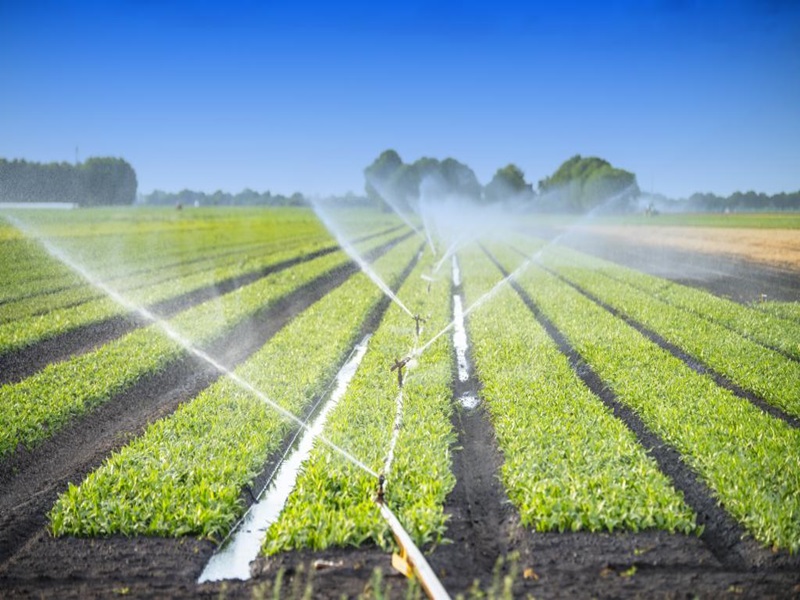
WP4 – Pilot application
Objectives: Pilot application of DT-Agro in Greece, calibration, validation and general evaluation of the digital twin, and assessment of historical and current conditions and future
Read more -
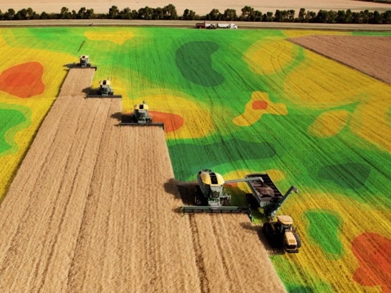
WP5 – Information Services
Objectives: Identification and adaptation of effective data analysis techniques for the utilization of the huge amounts of data originating from DT-Agro and earth observations. Analysis
Read more -

WP6 – Dissemination – Communication
Objectives: The main objective of this WP is to maximize the impact of the project and to enable the pathway of transition to digital and
Read more
-
Publication at Geosciences: Examination of empirical and Machine Learning methods for regression of missing or invalid solar radiation data using routine meteorological data as predictors
Read full publcation here: https://www.aimspress.com/article/10.3934/geosci.2024044?viewType Abstract Sensors are prone to malfunction, leading to blank or erroneous measurements that cannot be ignored in most practical applications. Therefore, data users are always looking for efficient methods to substitute missing values with accurate estimations. Traditionally, empirical methods have been used for this purpose, but with the increasing accessibility and effectiveness of Machine Learning (ML) methods, it is plausible that the former will be replaced by the latter. In this study, we aimed to provide some insights on the state of this question using the network of meteorological stations installed and operated by the GIS Research Unit of the Agricultural University of Athens in Nemea, Greece as a test site for the estimation of daily average solar radiation. Routine weather parameters from ten stations in a period spanning 1,548 days were collected, curated, and used for the training, calibration, and validation of different iterations of two empirical equations and three iterations each of Random Forest (RF) and Recurrent Neural Networks (RNN). The results indicated that while ML methods, and especially RNNs, are in general more accurate than their empirical counterparts, the investment in technical knowledge, time, and processing capacity they require for their implementation cannot constitute them as a panacea, as such selection for the best method is case-sensitive. Future research directions could include the examination of more location-specific models or the integration of readily available spatiotemporal indicators to increase model generalization.
Read more -
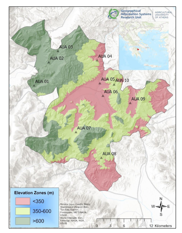
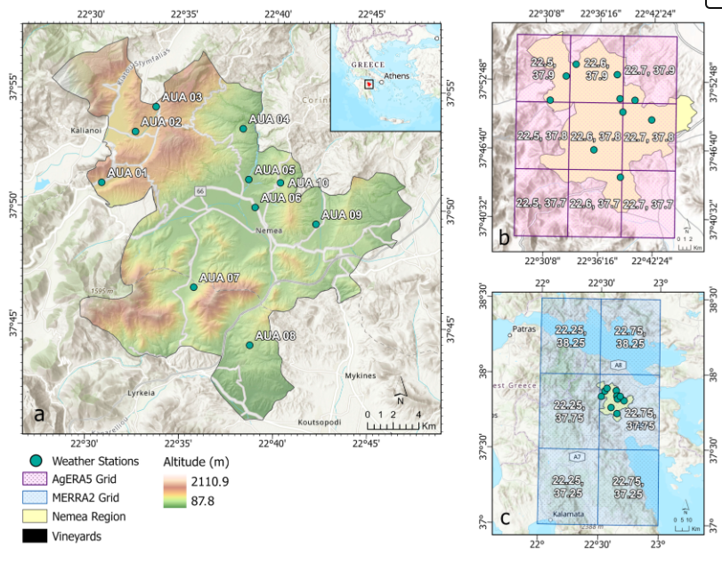
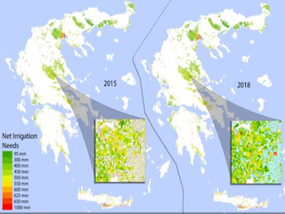
Publication: Assessing AgERA5 and MERRA-2 Global Climate Datasets for Small-Scale Agricultural Applications
Read the full publication here: https://www.mdpi.com/2073-4433/16/3/263 Abstract AgERA5 (ECMWF) is a relatively new climate dataset specifically designed for agricultural applications. MERRA-2 (NASA) is also used in agricultural applications; however, it was not specifically designed for this purpose. Despite the proven value of these datasets in assessing global climate patterns, their effectiveness in small-scale agricultural contexts remains unclear. This research aims to fill this gap by assessing the suitability and performance of AgERA5 and MERRA-2 in precision irrigation management, which is crucial for regions with limited ground data availability. The wine-making region of Nemea, Greece, with its complex and challenging terrain is used as a characteristic case study. The datasets are assessed for key weather variables and for irrigation planning, using detailed local meteorological station data as a reference. The results reveal that both products have serious limitations in small scale irrigation scheduling applications in contrast to what was reported in previous studies for other regions. The uneven performance of global datasets in different regions due to lack of sufficient observation data for reanalysis data calibration was also indicated. Comparing the two datasets, AgERA5 outperforms MERRA-2, especially in precipitation and reference evapotranspiration. MERRA-2 shows comparable potential in irrigation planning, as it occasionally matches or exceeds AgERA5’s performance. The study findings underscore the importance of evaluating metanalysis datasets in the application area before their use for precision agriculture, particularly in regions with complex topography.
Read more -
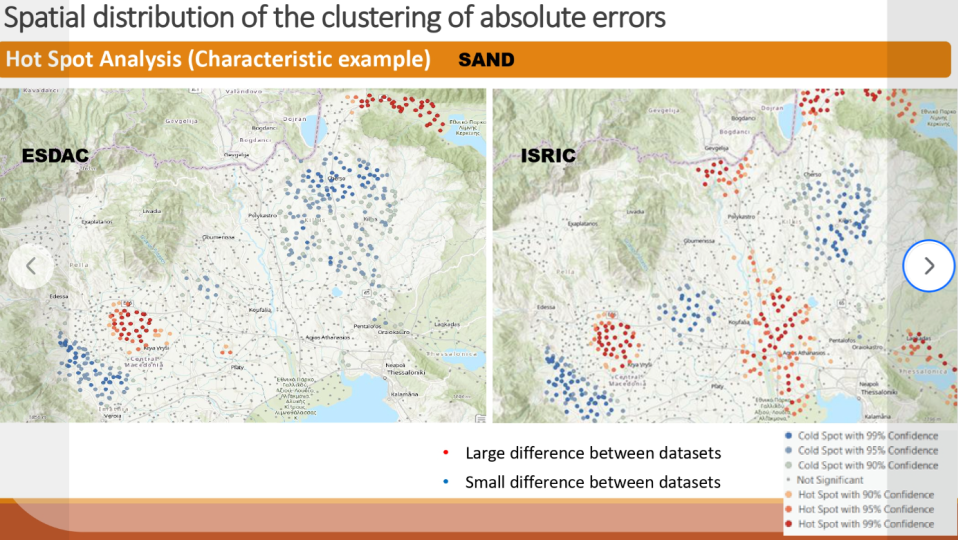
Publication at Soil Systems – November 2025
🌱📢Proud to share a 𝗻𝗲𝘄 𝗽𝘂𝗯𝗹𝗶𝗰𝗮𝘁𝗶𝗼𝗻 from the 𝗚𝗜𝗦 𝗥𝗲𝘀𝗲𝗮𝗿𝗰𝗵 𝗨𝗻𝗶𝘁 at the Agricultural University of Athens (gis.aua.gr) in 𝘚𝘰𝘪𝘭 𝘚𝘺𝘴𝘵𝘦𝘮𝘴! 𝘼𝙨𝙨𝙚𝙨𝙨𝙢𝙚𝙣𝙩 𝙤𝙛 𝙩𝙝𝙚 𝘼𝙘𝙘𝙪𝙧𝙖𝙘𝙮 𝙤𝙛 𝙄𝙎𝙍𝙄𝘾 𝙖𝙣𝙙 𝙀𝙎𝘿𝘼𝘾 𝙎𝙤𝙞𝙡 𝙏𝙚𝙭𝙩𝙪𝙧𝙚 𝘿𝙖𝙩𝙖 𝘾𝙤𝙢𝙥𝙖𝙧𝙚𝙙 𝙩𝙤 𝙩𝙝𝙚 𝙎𝙤𝙞𝙡 𝙈𝙖𝙥 𝙤𝙛 𝙂𝙧𝙚𝙚𝙘𝙚: 𝘼 𝙎𝙩𝙖𝙩𝙞𝙨𝙩𝙞𝙘𝙖𝙡 𝙖𝙣𝙙 𝙎𝙥𝙖𝙩𝙞𝙖𝙡 𝘼𝙥𝙥𝙧𝙤𝙖𝙘𝙝 𝙩𝙤 𝙄𝙙𝙚𝙣𝙩𝙞𝙛𝙮 𝙎𝙤𝙪𝙧𝙘𝙚𝙨 𝙤𝙛 𝘿𝙞𝙛𝙛𝙚𝙧𝙚𝙣𝙘𝙚𝙨 Our study evaluates global and European soil texture datasets against Greece’s national soil map (>10,000 samples). Results reveal significant discrepancies and low predictive accuracy, emphasizing the need for improved models in heterogeneous landscapes. Read the full article: https://lnkd.in/eyMyTmpP Authors: Stylianos Gerontidis, Konstantinos X. Soulis, Alexandros Stavropoulos, Evangelos Nikitakis, Dionissios P. Kalivas, Orestis Kairis, Dimitrios Kopanelis, Xenofon K. Soulis and Stergia Palli-Gravani
Read more